Trail Walking Cour-Maugis sur Huisne - La Clairière de Saint-Laurent Variante 12 Km - Photo

La Clairière de Saint-Laurent Variante 12 Km

 ODDAD78
ODDAD78

User

© OpenStreetMap contributors
Length
Length
12.5 km
Max alt
Max alt
249 m
Uphill gradient
Uphill gradient
202 m
Km-Effort
Km-Effort  
15.2 km
Min alt
Min alt
133 m
Downhill gradient
Downhill gradient
201 m
Boucle
Boucle
Yes
Creation date :
2019-04-13 16:34:31.647
Updated on :
2021-06-15 19:29:53.382

(0 Reviews)

Walking
Walking
3h14
Difficulty : Easy

Scan this QR Code to open this trail in the SityTrail application

FREE GPS app for hiking

Logo SityTrail SityTrail

IGN / Geographical institutes

Download SityTrail from the App Store Download SityTrail from Google Play

Logo SityTrail SityTrail World

The world is yours!

Download SityTrail from the App Store Download SityTrail from Google Play Download SityTrail on Huawei AppGallery

About

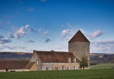
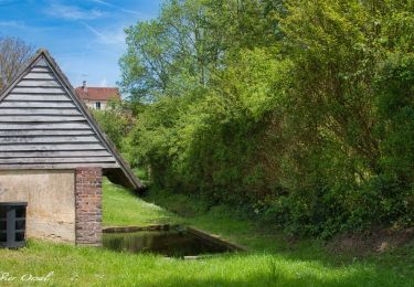
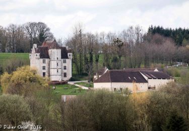
Trail Walking of 12.5 km to be discovered at Normandy, Orne, Cour-Maugis sur Huisne. This trail is proposed by ODDAD78.

Description

Circuit balisé en jaune   signalétique (suivre les flèches "La Clairière de Saint-Laurent Var")

Prendre à droite la rue de l'Église; gagner le carrefour D111-D10. Emprunter à droite la route de Monceaux-au-Perche. Passer devant le manoir de la Moussetière. La Petite Moussetière. Le Clos Saint Marc. Pomerai. La Butte de l’étang.
Après le hameau de la Repinçonnière, prendre à droite vers la Moisière. Continuer à gauche par un chemin de terre.
Au carrefour de la Diardière, tout droit vers la Fleurière. Tourner à droite, passer devant la Basse Chartrie; gagner le hameau de la Grande Foucaudière. Rejoindre la D612. Prendre à gauche la Départementale.
Passer devant Sauné. 300 m plus loin, quitter la D612; prendre à droite un chemin en sous-bois, puis en lisière. À une intersection en fourche, à droite, pour atteindre le chemin de la Butte Maurandière. Continuer tout droit en ignorant, à gauche, la Fosse Villon. Emprunter une longue ligne droite à travers le bois de Saint Laurent ; traverser la route de la Robichonnière. Tout droit pour aboutir à un chemin en, lisière de bois. À droite.
À l'intersection en fourche, obliquer à gauche et, 120 m plus loin, à droite pour gagner le hameau de la Chaloudière. Rejoindre la D612.
Retour au point de départ, à gauche, par la Départementale.

Elevation profile

Photos

Positioning

Country:
France
Region :
Normandy
Department/Province :
Orne
Municipality :
Cour-Maugis sur Huisne
Location:
Unknown
Start:(UTM)
330784 ; 5367901 (31U) N.

Trails nearby

Trail Walking Longny les Villages - Monceaux au Perche (Boucle) - Photo
Walking
neitag61

Walking

Easy
(2)
Longny les Villages, Normandy, Orne, France
10.6 km | 13.5 km-effort
2h 30min
Yes
Trail Walking Rémalard en Perche - 2023-05-11_20h45m08_Randos 61 2023 3 Sur les terres du siège de Rémalard 9,5 km - Photo
Walking
ODDAD78

Walking

Medium
Rémalard en Perche, Normandy, Orne, France
9.5 km | 10.9 km-effort
2h 28min
Yes
Trail Walking La Chapelle-Montligeon - [Itinéraire] Le Mont Ligeon - Photo
Walking
ODDAD78

Walking

Medium
La Chapelle-Montligeon, Normandy, Orne, France
5.1 km | 6.6 km-effort
1h 30min
Yes
Trail Walking Cour-Maugis sur Huisne - 12102996-Maison Maugis 22.37 - Photo
Walking
togolo28

Walking

Medium
(1)
Cour-Maugis sur Huisne, Normandy, Orne, France
22 km | 28 km-effort
Unknown
Yes
Trail Walking Perche en Nocé - manoir courbpyer - Photo
Walking
fournieralain

Walking

Very easy
Perche en Nocé, Normandy, Orne, France
12.8 km | 16.4 km-effort
4h 29min
Yes
Trail Walking La Chapelle-Montligeon - La Chapelle-Montligeon - Longny-au-Perche via Bizou 16 km - Photo
Walking

Walking

Very difficult
La Chapelle-Montligeon, Normandy, Orne, France
15.9 km | 20 km-effort
4h 22min
No
Trail Walking La Chapelle-Montligeon - La Chapelle-Montligeon - Moutiers-au-Perche via Bizou 20 km - Photo
Walking

Walking

Very difficult
La Chapelle-Montligeon, Normandy, Orne, France
20 km | 26 km-effort
5h 33min
No
Trail Walking La Chapelle-Montligeon - La Chapelle-Montligeon - Le Mage via Bizou 18 km - Photo
Walking

Walking

Very difficult
La Chapelle-Montligeon, Normandy, Orne, France
17.9 km | 23 km-effort
4h 53min
No
Trail Walking Perche en Nocé - SityTrail - La Maison du bois Nocé 11 Km - Photo
Walking
ODDAD78

Walking

Difficult
Perche en Nocé, Normandy, Orne, France
10.8 km | 13.3 km-effort
2h 49min
Yes


Close
My subscriptions